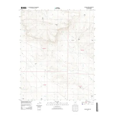
2013 Map of Alamosa Creek
USGS Topo · Published 2013About this map
Daniels Ranch and Thompson Ranch anchor this high-plains landscape in Mora County, where the terrain is defined by a network of drainage systems and intermittent water sources. These ranching outposts are situated along the lower reaches of Carrizo Cr and Vermejo Cr, showcasing the historical reliance on seasonal water in this part of New Mexico. The geography is punctuated by significant elevation changes, from the heights of Las Mesas Del Conjelon in the north to the Cuernudo Hills in the east.
Find a feature on this map
26 named features on this map. Tap any name to fly to it.
Don’t see what you’re looking for? This feature index may not catch every label — zoom into the map to look around manually.
Map Details
Editions of this 2013 Alamosa Creek Map
This is the sole edition of this map. No revisions or reprints were ever made.
Other maps of this area

1892 · Watrous
USGS Topo · 1:125,000

1894 · Watrous
USGS Topo · 1:125,000

1954 · Santa Fe
USGS Topo · 1:250,000

1954 · Raton
USGS Topo · 1:250,000

1958 · Raton
USGS Topo · 1:250,000

1958 · Santa Fe
USGS Topo · 1:250,000

1964 · Wagon Mound
USGS Topo · 1:24,000

1964 · Alto De Hormiga
USGS Topo · 1:24,000

1964 · Frutosa Lake
USGS Topo · 1:24,000

1964 · Mogote Hills
USGS Topo · 1:24,000