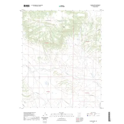
2023 Map of Alamosa Creek
USGS Topo · Published 2023About this map
Las Mesas Del Conjelon and the high plateaus of Mora County dominate this landscape, where the drainage network of the Alamosa Creek basin creates a complex system of canyons and draws. This modern survey illustrates the persistent importance of water sources in the high desert, documenting named points such as Bootlegger Spring, Mayes Spring, and El Rincon Spring. The terrain transitions from the elevated Cuernudo Hills down toward several seasonal watercourses including Carrizo Creek and Vermejo Creek. While State Hwy 271 provides the primary transit corridor through the southern reaches, the map's higher elevations are defined by names that reflect a history of ranching and settlement, such as Bootlegger Canyon and Arroyo Piedra-Lumbre, providing a precise look at the land's current character.
Find a feature on this map
21 named features on this map. Tap any name to fly to it.
Don’t see what you’re looking for? This feature index may not catch every label — zoom into the map to look around manually.
Map Details
Editions of this 2023 Alamosa Creek Map
This is the sole edition of this map. No revisions or reprints were ever made.
Other maps of this area

1892 · Watrous
USGS Topo · 1:125,000

1894 · Watrous
USGS Topo · 1:125,000

1954 · Santa Fe
USGS Topo · 1:250,000

1954 · Raton
USGS Topo · 1:250,000

1958 · Raton
USGS Topo · 1:250,000

1958 · Santa Fe
USGS Topo · 1:250,000

1964 · Wagon Mound
USGS Topo · 1:24,000

1964 · Alto De Hormiga
USGS Topo · 1:24,000

1964 · Frutosa Lake
USGS Topo · 1:24,000

1964 · Mogote Hills
USGS Topo · 1:24,000