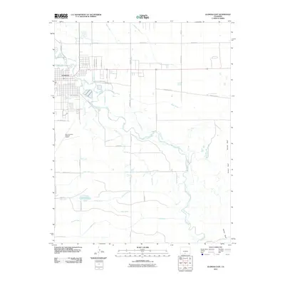
2010 Map of Alamosa East
USGS Topo · Published 2010About this map
The city of Alamosa anchors this landscape in the San Luis Valley, where an extensive network of human-made waterways manages the high-desert environment. This 2010 survey highlights the complex irrigation system supporting local agriculture, featuring major channels like the Excelsior Ditch, Maddux Ditch, and Costilla Canal. These arteries pull from the Rio Grande and the Alamosa River, crisscrossing the terrain to sustain the region's ranching and farming operations.
Find a feature on this map
41 named features on this map. Tap any name to fly to it.
Don’t see what you’re looking for? This feature index may not catch every label — zoom into the map to look around manually.
Map Details
Editions of this 2010 Alamosa East Map
This is the sole edition of this map. No revisions or reprints were ever made.
Other maps of this area

1954 · Trinidad
USGS Topo · 1:250,000

1955 · Trinidad
USGS Topo · 1:250,000

1958 · Trinidad
USGS Topo · 1:250,000

1959 · Trinidad
USGS Topo · 1:250,000

1965 · Baldy
USGS Topo · 1:24,000

1965 · Lasauses
USGS Topo · 1:24,000

1965 · Dry Lakes
USGS Topo · 1:24,000
1966 · Mount Pleasant School
USGS Topo · 1:24,000
1966 · Hooper SE
USGS Topo · 1:24,000
1966 · Alamosa East
USGS Topo · 1:24,000