1966 Map of Alamosa East
USGS Topo · Published 1968About this map
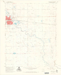
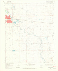
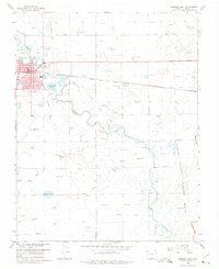
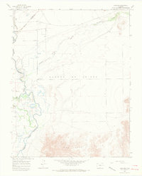
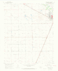
The city of Alamosa serves as the focal point for this mid-1960s study of the San Luis Valley, revealing an urban core defined by its Courthouse and the Boyd Sch. The landscape is intricately managed through an extensive network of irrigation and drainage infrastructure, including the Waverly Drain, Costilla Canal, and Seamans Ditch, which redirect water across the flat basin. This water management is vital for the region's agricultural character, evidenced by the numerous flowing wells scattered across the valley floor.
Find a feature on this map
28 named features on this map. Tap any name to fly to it.
Don’t see what you’re looking for? This feature index may not catch every label — zoom into the map to look around manually.
Map Details
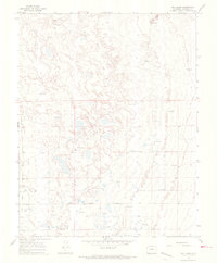
Editions of this 1966 Alamosa East Map
3 editions found
Other maps of this area

1954 · Trinidad
USGS Topo · 1:250,000

1955 · Trinidad
USGS Topo · 1:250,000

1958 · Trinidad
USGS Topo · 1:250,000

1959 · Trinidad
USGS Topo · 1:250,000
1965 · Baldy
USGS Topo · 1:24,000
1965 · Lasauses
USGS Topo · 1:24,000
1965 · Dry Lakes
USGS Topo · 1:24,000
1966 · Mount Pleasant School
USGS Topo · 1:24,000
1966 · Hooper SE
USGS Topo · 1:24,000
1966 · Alamosa West
USGS Topo · 1:24,000