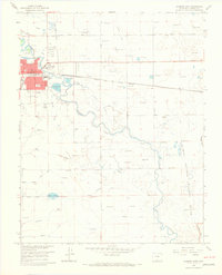
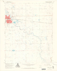
1966 Map of Alamosa East
USGS Topo · Published 1968About this map
The Rio Grande and its complex network of irrigation channels define this San Luis Valley landscape during the mid-1960s. The city of Alamosa serves as the regional hub, where the Denver and Rio Grande Western railroad corridors meet the urban grid containing the local Courthouse and Boyd Sch. The surrounding terrain is characterized by an intensive water-management system essential for high-altitude agriculture, featuring named works such as the Excelsior Ditch, Chicago Ditch, and Waverly Drain. To the east, the Alamosa National Wildlife Refuge preserves the riparian wetlands along the river's winding course toward Hansen Bluff. This survey also records important civic infrastructure of the era, from the Alamosa Municipal Airport to the Municipal Golf Course, alongside rural landmarks like Adams Lake and various gravel pits.
Find a feature on this map
31 named features on this map. Tap any name to fly to it.
Don’t see what you’re looking for? This feature index may not catch every label — zoom into the map to look around manually.
Map Details
Editions of this 1966 Alamosa East Map
3 editions found
Other maps of this area

1954 · Trinidad
USGS Topo · 1:250,000

1955 · Trinidad
USGS Topo · 1:250,000

1958 · Trinidad
USGS Topo · 1:250,000

1959 · Trinidad
USGS Topo · 1:250,000

1965 · Baldy
USGS Topo · 1:24,000

1965 · Lasauses
USGS Topo · 1:24,000

1965 · Dry Lakes
USGS Topo · 1:24,000
1966 · Mount Pleasant School
USGS Topo · 1:24,000
1966 · Hooper SE
USGS Topo · 1:24,000
1966 · Alamosa East
USGS Topo · 1:24,000