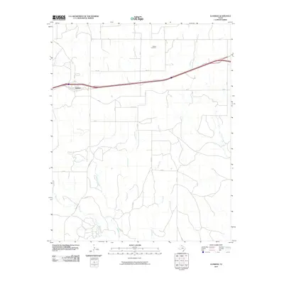
2010 Map of Alanreed
USGS Topo · Published 2010About this map
Alanreed serves as the primary settlement on this map, located at a significant transit corridor where Service Rd and 3rd Ave intersect with FM 291. The geography is defined by a series of south-flowing waterways including Whitefish Creek, Mitchell Creek, and Rock Creek, which cut through the high plains of the Texas Panhandle. To the north, the Cubine Lake Dam represents a managed water resource amidst a grid of rural county roads such as Gray AA and BB RD. This landscape illustrates the spatial arrangement of a modern ranching and transit-oriented community, where traditional land divisions meet the infrastructure of interstate travel. The intricate network of local routes like CC RD and Co Rd B highlights the connectivity required for rural land management in this portion of Gray County.
Find a feature on this map
30 named features on this map. Tap any name to fly to it.
Don’t see what you’re looking for? This feature index may not catch every label — zoom into the map to look around manually.
Map Details
Editions of this 2010 Alanreed Map
This is the sole edition of this map. No revisions or reprints were ever made.
Other maps of this area

1954 · Amarillo
USGS Topo · 1:250,000

1958 · Amarillo
USGS Topo · 1:250,000

1959 · Troublesome Creek
USGS Topo · 1:24,000

1959 · Spencer Lake
USGS Topo · 1:24,000

1962 · Griffin Ranch
USGS Topo · 1:24,000

1962 · Hudgens Ranch
USGS Topo · 1:24,000

1962 · Back
USGS Topo · 1:24,000

1963 · Alanreed
USGS Topo · 1:24,000

1963 · McLean
USGS Topo · 1:24,000

1964 · Rockledge
USGS Topo · 1:24,000