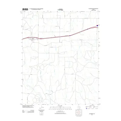
2012 Map of Alanreed
USGS Topo · Published 2012About this map
Alanreed stands as the primary settlement on this Texas Panhandle landscape, where the local street grid including Main, W 2nd, and 2nd Ave intersects with major transport corridors. The map details the transition of local ranching infrastructure into the modern highway era, with the path of the interstate flanked by Frontage Rd and Service Dr. Beyond the town center, the terrain is defined by a dendritic network of drainage ways. Watercourses such as Whitefish Cr, Mitchell Cr, and Skillet Cr cut through the high plains, shaping the placement of rural routes like Ranch Road 121 and Country Club Rd. This survey documents the intersection of essential Panhandle ranch roads with the vital east-west transit artery that serves the region.
Find a feature on this map
40 named features on this map. Tap any name to fly to it.
Don’t see what you’re looking for? This feature index may not catch every label — zoom into the map to look around manually.
Map Details
Editions of this 2012 Alanreed Map
This is the sole edition of this map. No revisions or reprints were ever made.
Other maps of this area

1954 · Amarillo
USGS Topo · 1:250,000

1958 · Amarillo
USGS Topo · 1:250,000

1959 · Troublesome Creek
USGS Topo · 1:24,000

1959 · Spencer Lake
USGS Topo · 1:24,000

1962 · Griffin Ranch
USGS Topo · 1:24,000

1962 · Hudgens Ranch
USGS Topo · 1:24,000

1962 · Back
USGS Topo · 1:24,000

1963 · Alanreed
USGS Topo · 1:24,000

1963 · McLean
USGS Topo · 1:24,000

1964 · Rockledge
USGS Topo · 1:24,000