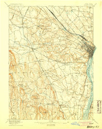
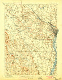
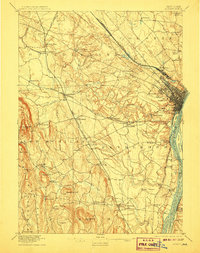
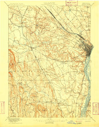
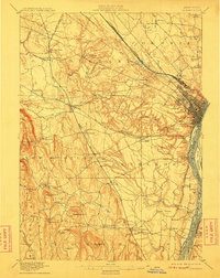
1898 Map of Albany
USGS Topo · Published 1905About this map
The Hudson River serves as the eastern anchor of this late nineteenth-century landscape, where the bustling city of Albany transitions into the agricultural and industrial towns of Colonie, Guilderland, and Bethlehem. The topography reveals a complex network of waterways like the Normans Kill and Oniskethau Creek carving through the terrain towards the river valley. Notable social and industrial nodes include the settlement of Shakers in the north and French Mills to the west, reflecting the era's diverse communal and manufacturing footprints.
Find a feature on this map
91 named features on this map. Tap any name to fly to it.
Don’t see what you’re looking for? This feature index may not catch every label — zoom into the map to look around manually.
Map Details
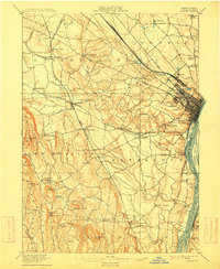
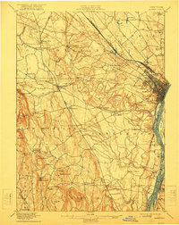
Editions of this 1898 Albany Map
8 editions found

Other maps of this area

1893 · Cohoes
USGS Topo · 1:62,500

1893 · Troy
USGS Topo · 1:62,500

1893 · Schenectady
USGS Topo · 1:62,500

1893 · Coxsackie
USGS Topo · 1:62,500

1893 · Durham
USGS Topo · 1:62,500

1893 · Albany
USGS Topo · 1:62,500

1894 · Coxsackie
USGS Topo · 1:62,500

1894 · Durham
USGS Topo · 1:62,500

1895 · Troy
USGS Topo · 1:62,500

1895 · Cohoes
USGS Topo · 1:62,500