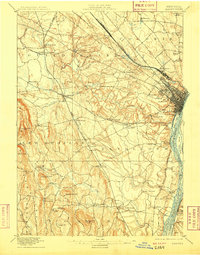
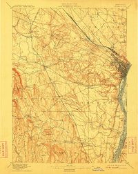
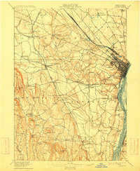
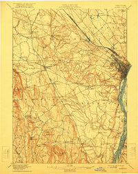
1898 Map of Albany
USGS Topo · Published 1909About this map
The Hudson River corridor and its western uplands are surveyed here during the late nineteenth century, revealing a landscape defined by water power and burgeoning rail lines. The city of Albany dominates the eastern edge, with its riverfront islands like Westerlo Island and Papscanee Island still largely undeveloped. To the west, the Helderberg Mountains rise toward Countryman Hill and Wolf Hill, shaping the drainage of the Normans Kill and Oniskethau Creek. Small industrial and agricultural hamlets like French Mills and Guilderland Center are connected by a dense web of steel, including the New York Central and Hudson River RR and the West Shore RR. Notable rural enclaves such as the Shakers settlement north of Albany and the local center of South Bethlehem provide a detailed look at the settlement patterns of Albany County before modern suburban expansion.
Find a feature on this map
87 named features on this map. Tap any name to fly to it.
Don’t see what you’re looking for? This feature index may not catch every label — zoom into the map to look around manually.
Map Details
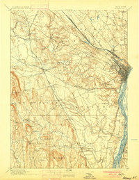
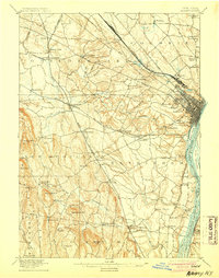
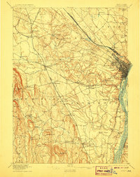
Editions of this 1898 Albany Map
8 editions found

Other maps of this area

1893 · Cohoes
USGS Topo · 1:62,500

1893 · Troy
USGS Topo · 1:62,500

1893 · Schenectady
USGS Topo · 1:62,500

1893 · Coxsackie
USGS Topo · 1:62,500

1893 · Durham
USGS Topo · 1:62,500

1893 · Albany
USGS Topo · 1:62,500

1894 · Coxsackie
USGS Topo · 1:62,500

1894 · Durham
USGS Topo · 1:62,500

1895 · Troy
USGS Topo · 1:62,500

1895 · Cohoes
USGS Topo · 1:62,500