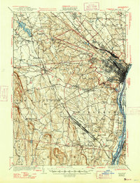
1927 Map of Albany
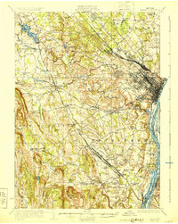
USGS Topo · Published 1947About this map
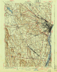
Selkirk Yards and the sprawling rail networks of the New York Central RR and the West Shore RR define the industrial and transit character of this region south of Albany. In the late 1920s, the landscape was a complex mix of river-front commerce along the Hudson River and established agricultural townships. The Castleton Cut-Off crosses the river over Beacon Island and Schodack Island, bypassing the congested city center for more efficient freight movement.
Find a feature on this map
122 named features on this map. Tap any name to fly to it.
Don’t see what you’re looking for? This feature index may not catch every label — zoom into the map to look around manually.
Map Details
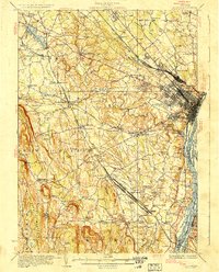
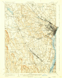
Editions of this 1927 Albany Map
5 editions found
Other maps of this area

1893 · Cohoes
USGS Topo · 1:62,500

1893 · Troy
USGS Topo · 1:62,500

1893 · Schenectady
USGS Topo · 1:62,500

1893 · Coxsackie
USGS Topo · 1:62,500

1893 · Durham
USGS Topo · 1:62,500

1893 · Albany
USGS Topo · 1:62,500

1894 · Coxsackie
USGS Topo · 1:62,500

1894 · Durham
USGS Topo · 1:62,500

1895 · Troy
USGS Topo · 1:62,500

1895 · Cohoes
USGS Topo · 1:62,500