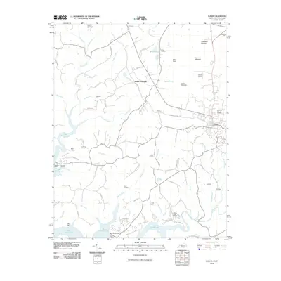
2010 Map of Albany
USGS Topo · Published 2010About this map
The town of Albany serves as the central hub of this survey, surrounded by a landscape defined by the branching arms of Dale Hollow Lake and the high points of the Cumberland Plateau. In the north, Huddleston Mountain and Burchett Mountain rise above a network of family-named roads and burial grounds including Boyles Cemetery and Hopkins Cemetery. The map captures a moment in the region's modern development, showing the proximity of localized commerce at Browns Crossroads to the recreational and nautical access points at Wolf River Dock.
Find a feature on this map
77 named features on this map. Tap any name to fly to it.
Don’t see what you’re looking for? This feature index may not catch every label — zoom into the map to look around manually.
Map Details
Editions of this 2010 Albany Map
This is the sole edition of this map. No revisions or reprints were ever made.
Other maps of this area

1924 · Lillydale
USGS Topo · 1:62,500

1926 · Lillydale
USGS Topo · 1:62,500

1929 · Lillydale
USGS Topo · 1:62,500

1929 · Byrdstown
USGS Topo · 1:62,500

1953 · Burkesville
USGS Topo · 1:24,000

1953 · Wolf Creek Dam
USGS Topo · 1:24,000

1954 · Frogue
USGS Topo · 1:24,000

1954 · Cumberland City
USGS Topo · 1:24,000

1954 · Albany
USGS Topo · 1:24,000

1954 · Savage
USGS Topo · 1:24,000