
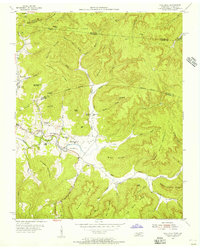
1954 Map of Savage
USGS Topo · Published 1955About this map
Poplar Mountain dominates this mid-century landscape of south-central Kentucky, where the high ridges of the Cumberland Plateau meet the rolling farmlands of the Pennyroyal. Small rural settlements like Upchurch, Savage, and Rolan are linked by a dense network of country schools including Pikeview Sch and Concord Sch. The map reveals a community structured around its water sources and topography, from the drainage of Spring Creek to the prominent heights of Jacks Knob and Jennys Knob.
Find a feature on this map
55 named features on this map. Tap any name to fly to it.
Don’t see what you’re looking for? This feature index may not catch every label — zoom into the map to look around manually.
Map Details
Editions of this 1954 Savage Map
This is the sole edition of this map. No revisions or reprints were ever made.
Other maps of this area

1911 · Monticello
USGS Topo · 1:62,500

1914 · Monticello
USGS Topo · 1:62,500

1929 · Byrdstown
USGS Topo · 1:62,500

1934 · Pall Mall
USGS Topo · 1:62,500

1953 · Parnell
USGS Topo · 1:24,000

1953 · Wolf Creek Dam
USGS Topo · 1:24,000

1954 · Cumberland City
USGS Topo · 1:24,000

1954 · Albany
USGS Topo · 1:24,000

1954 · Powersburg
USGS Topo · 1:24,000
1954 · Pall Mall
USGS Topo · 1:24,000