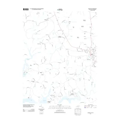
2013 Map of Albany
USGS Topo · Published 2013About this map
Albany serves as the regional hub of Clinton County, Kentucky, where the grid of streets like 1st St and S Hospital St gives way to a complex landscape of ridges and hollows. The terrain is defined by prominent elevations such as Huddleston Mountain and Burchett Mountain, while the southern reaches of the map are dominated by the winding fingers of Dale Hollow Lake. This area reflects a deep-rooted rural community, evidenced by numerous family and church burial grounds, including the Memorial Hill Cem and the Cedar Hill Church Cem. The mapping records a mix of traditional agriculture and more modern infrastructure, from the Clinton County Fairgrounds to the Dale Hollow Regional Airport (Petro Field). Along the water, the Wolf River Dock points to the area's importance for local recreation and river access, while smaller settlements like Shipley and Browns Crossroads anchor the crossroads of the backcountry.
Find a feature on this map
159 named features on this map. Tap any name to fly to it.
Don’t see what you’re looking for? This feature index may not catch every label — zoom into the map to look around manually.
Map Details
Editions of this 2013 Albany Map
This is the sole edition of this map. No revisions or reprints were ever made.
Other maps of this area

1924 · Lillydale
USGS Topo · 1:62,500

1926 · Lillydale
USGS Topo · 1:62,500

1929 · Lillydale
USGS Topo · 1:62,500

1929 · Byrdstown
USGS Topo · 1:62,500

1953 · Burkesville
USGS Topo · 1:24,000

1953 · Wolf Creek Dam
USGS Topo · 1:24,000

1954 · Frogue
USGS Topo · 1:24,000

1954 · Cumberland City
USGS Topo · 1:24,000

1954 · Albany
USGS Topo · 1:24,000

1954 · Savage
USGS Topo · 1:24,000