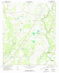
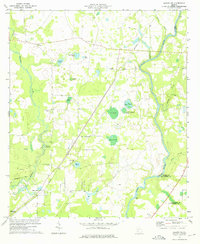
1973 Map of Albany NE
USGS Topo · Published 1991About this map
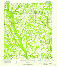
Flint River and Muckalee Creek meander through this rural Georgia landscape at the junction of Lee, Worth, and Dougherty Counties. The terrain is defined by its diverse wetlands and ponds, including Stocks Pond, Fox Pond, and Duck Roost Pond, which punctuate the agricultural and timbered lands. Local heritage is preserved in the numerous country churches and cemeteries that anchor these rural communities, such as Thundering Springs Ch and the nearby Thundering Springs Cem.
Find a feature on this map
39 named features on this map. Tap any name to fly to it.
Don’t see what you’re looking for? This feature index may not catch every label — zoom into the map to look around manually.
Map Details
Editions of this 1973 Albany NE Map
2 editions found
Other maps of this area

1953 · Dothan
USGS Topo · 1:250,000

1953 · Waycross
USGS Topo · 1:250,000

1954 · Dothan
USGS Topo · 1:250,000

1955 · Dothan
USGS Topo · 1:250,000
1956 · Albany East
USGS Topo · 1:24,000
1956 · Albany West
USGS Topo · 1:24,000

1956 · Sylvester
USGS Topo · 1:62,500

1956 · Albany
USGS Topo · 1:62,500
1956 · Leslie
USGS Topo · 1:62,500

1958 · Waycross
USGS Topo · 1:250,000