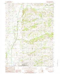
1984 Map of Albany North
USGS Topo · Published 1985About this map
The East Fork Grand River defines the western edge of this agricultural landscape in Gentry County, Missouri, during the mid-1980s. The topography is marked by a network of drainage systems including Dawson Branch, Panther Creek, and Big Muddy Creek, which cut through the townships of Howard and Athens. Small, rural nodes like Ellenorah, Lone Star, and Pinhook represent the persistence of old settlement patterns in the northern reaches of the county. Near the southern border, the map transitions into the outskirts of Albany, showing the transition from open farmland and wooded draws to municipal features such as the Golf Course. Genealogists may find interest in the scattered Cem locations and the historical hamlets of Weldon and Siloam Springs that dot the landscape between the ridges.
Find a feature on this map
21 named features on this map. Tap any name to fly to it.
Don’t see what you’re looking for? This feature index may not catch every label — zoom into the map to look around manually.
Map Details
Editions of this 1984 Albany North Map
This is the sole edition of this map. No revisions or reprints were ever made.
Other maps of this area

1925 · Pattonsburg
USGS Topo · 1:62,500

1925 · Darlington
USGS Topo · 1:62,500

1942 · Grant City
USGS Topo · 1:62,500

1943 · Grant City
USGS Topo · 1:62,500

1944 · Pattonsburg
USGS Topo · 1:62,500

1946 · Pattonsburg
USGS Topo · 1:48,000

1948 · Bethany
USGS Topo · 1:62,500

1948 · Pattonsburg
USGS Topo · 1:62,500

1950 · Darlington
USGS Topo · 1:62,500

1955 · Nebraska City
USGS Topo · 1:250,000