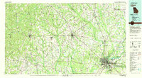
1981 Map of Albany
USGS Topo · Published 1982About this map
Albany serves as the primary urban hub on this 1980s-era map of Southwest Georgia, where the Flint River meets a network of converging rail lines including the Central of Georgia and Seaboard Coast Line. The landscape is defined by the agricultural and natural transition of the Upper Coastal Plain, with numerous tributaries such as Kinchafoonee Creek and Muckalee Creek snaking through a mosaic of woodland and cropland. To the northeast of the city, Chehaw State Park and the U S Naval Reservation occupy significant tracts near the riverbanks.
Find a feature on this map
101 named features on this map. Tap any name to fly to it.
Don’t see what you’re looking for? This feature index may not catch every label — zoom into the map to look around manually.
Map Details
Editions of this 1981 Albany Map
This is the sole edition of this map. No revisions or reprints were ever made.
Other maps of this area

1950 · Lumpkin
USGS Topo · 1:24,000

1950 · Lumpkin SW
USGS Topo · 1:24,000

1950 · Lumpkin
USGS Topo · 1:62,500

1953 · Dothan
USGS Topo · 1:250,000

1953 · Waycross
USGS Topo · 1:250,000

1954 · Dothan
USGS Topo · 1:250,000

1955 · Dothan
USGS Topo · 1:250,000

1955 · Lumpkin
USGS Topo · 1:24,000

1955 · Lumpkin SW
USGS Topo · 1:24,000

1955 · Lumpkin
USGS Topo · 1:62,500