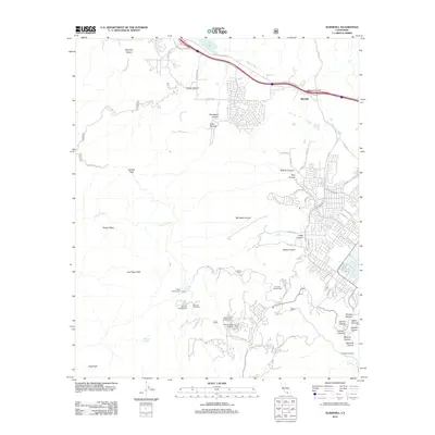
2012 Map of Alberhill
USGS Topo · Published 2012About this map
Alberhill serves as a primary reference point in this portion of Riverside County, where the transition from the valley floor to the high ridges of the Santa Ana Mountains is marked by a complex network of canyons and peaks. The landscape is defined by significant elevations such as Trabuco Peak and Los Pinos Peak, while the lowland areas are carved by the Temescal Wash and Arroyo Trabuco. Residential development and local infrastructure are concentrated toward the eastern edge near Lake Elsinore, with various recreation sites like El Cariso Campground and Blue Jay Campground positioned at higher altitudes.
Find a feature on this map
66 named features on this map. Tap any name to fly to it.
Don’t see what you’re looking for? This feature index may not catch every label — zoom into the map to look around manually.
Map Details
Editions of this 2012 Alberhill Map
This is the sole edition of this map. No revisions or reprints were ever made.
Other maps of this area

1901 · Southern California Sheet No. 1
USGS Topo · 1:250,000

1901 · Elsinore
USGS Topo · 1:125,000

1901 · Riverside
USGS Topo · 1:62,500

1902 · Corona
USGS Topo · 1:125,000

1904 · Southern California Sheet No. 1
USGS Topo · 1:250,000

1942 · Lake Elsinore
USGS Topo · 1:62,500

1942 · Santiago Peak
USGS Topo · 1:62,500

1942 · Corona
USGS Topo · 1:62,500

1942 · Riverside
USGS Topo · 1:62,500
1943 · Corona
USGS Topo · 1:62,500