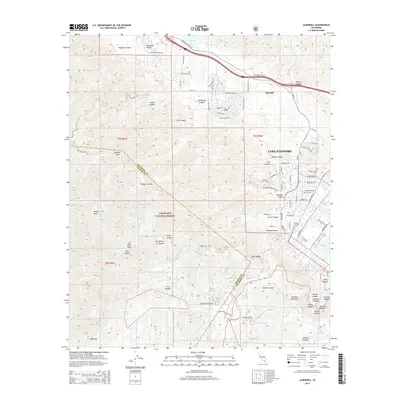
2015 Map of Alberhill
USGS Topo · Published 2015About this map
The community of Alberhill and the growing residential peripheries of Lake Elsinore anchor this 2015 study of the Santa Ana Mountains' eastern slopes. The landscape is defined by the steep transition from the Elsinore Mountains and the heights of Trabuco Peak down into the Temescal Valley. Within the Cleveland National Forest, the map traces the deep drainage networks of Trabuco Canyon and Hot Spring Canyon, illustrating the topographical complexity of the Orange and Riverside County line. Along the canyon floors and valley flats, human imprints range from the Mc Conville Airstrip to a dense network of suburban streets like McVicker Canyon Park Rd and Cherry Blossom Ln. This documentation shows the intersection of protected wilderness areas with the modern expansion of Inland Empire communities, capturing the precise footprint of development near Temescal Wash and Lee Lake.
Find a feature on this map
103 named features on this map. Tap any name to fly to it.
Don’t see what you’re looking for? This feature index may not catch every label — zoom into the map to look around manually.
Map Details
Editions of this 2015 Alberhill Map
This is the sole edition of this map. No revisions or reprints were ever made.
Other maps of this area

1901 · Southern California Sheet No. 1
USGS Topo · 1:250,000

1901 · Elsinore
USGS Topo · 1:125,000

1901 · Riverside
USGS Topo · 1:62,500

1902 · Corona
USGS Topo · 1:125,000

1904 · Southern California Sheet No. 1
USGS Topo · 1:250,000

1942 · Lake Elsinore
USGS Topo · 1:62,500

1942 · Santiago Peak
USGS Topo · 1:62,500

1942 · Corona
USGS Topo · 1:62,500

1942 · Riverside
USGS Topo · 1:62,500
1943 · Corona
USGS Topo · 1:62,500