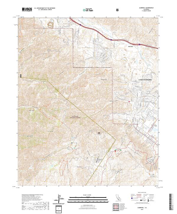
2021 Map of Alberhill
USGS Topo · Published 2021About this map
The Alberhill and Lake Elsinore interface in Riverside County is defined by the steep transition from the Santa Ana Mountains to the Temescal Valley. Much of the western terrain is protected within the Cleveland National Forest, where high points like Trabuco Peak and Los Pinos Peak dominate the skyline. This 2021 survey illustrates a landscape where modern residential developments, such as those along Horse Thief Canyon Rd, push against the drainage systems of Temescal Wash and Lee Lake.
Find a feature on this map
136 named features on this map. Tap any name to fly to it.
Don’t see what you’re looking for? This feature index may not catch every label — zoom into the map to look around manually.
Map Details
Editions of this 2021 Alberhill Map
This is the sole edition of this map. No revisions or reprints were ever made.
Other maps of this area

1901 · Southern California Sheet No. 1
USGS Topo · 1:250,000

1901 · Elsinore
USGS Topo · 1:125,000

1901 · Riverside
USGS Topo · 1:62,500

1902 · Corona
USGS Topo · 1:125,000

1904 · Southern California Sheet No. 1
USGS Topo · 1:250,000

1942 · Lake Elsinore
USGS Topo · 1:62,500

1942 · Santiago Peak
USGS Topo · 1:62,500

1942 · Corona
USGS Topo · 1:62,500

1942 · Riverside
USGS Topo · 1:62,500
1943 · Corona
USGS Topo · 1:62,500