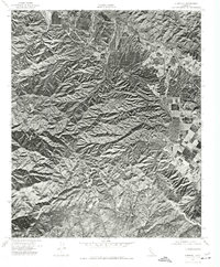
1974 Map of Alberhill
USGS Topo · Published 1977About this map
Temescal Valley defines the northeastern corridor of this 1974 orthophotoquad, showing the transition from the valley floor to the high elevations of the Santa Ana Mountains. The settlement of Alberhill is visible where the valley narrows, a location long known for its clay deposits and industrial activity. To the west, the landscape rises sharply toward the prominent summit of Trabuco Peak, which stands as a clear geographical anchor for the region. Because this is an orthophoto-based map, it provides an unfiltered visual record of the land use in the mid-1970s, from the geometric patterns of valley development and roads to the intricate, shadowed drainage systems of the mountain slopes. Researchers can observe the density of vegetation and the specific footprint of the built environment before later decades of suburban expansion reached this portion of Riverside County.
Find a feature on this map
3 named features on this map. Tap any name to fly to it.
Don’t see what you’re looking for? This feature index may not catch every label — zoom into the map to look around manually.
Map Details
Editions of this 1974 Alberhill Map
This is the sole edition of this map. No revisions or reprints were ever made.
Other maps of this area

1901 · Southern California Sheet No. 1
USGS Topo · 1:250,000

1901 · Elsinore
USGS Topo · 1:125,000

1901 · Riverside
USGS Topo · 1:62,500

1902 · Corona
USGS Topo · 1:125,000

1904 · Southern California Sheet No. 1
USGS Topo · 1:250,000

1942 · Lake Elsinore
USGS Topo · 1:62,500

1942 · Santiago Peak
USGS Topo · 1:62,500

1942 · Corona
USGS Topo · 1:62,500

1942 · Riverside
USGS Topo · 1:62,500
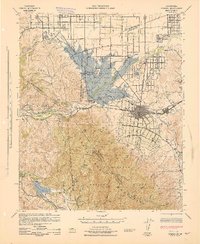
1943 · Corona
USGS Topo · 1:62,500