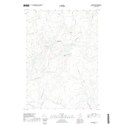
2019 Map of Albert Marsh
USGS Topo · Published 2019About this map
Gleasons Mill sits at a historic crossing where several local routes converged near the North Branch Grass River. This portion of Saint Lawrence County is defined by the extensive wetlands of the Adirondack Park Preserve, specifically around the namesake Albert Marsh. The terrain is characterized by numerous small, distinct water bodies such as Marsh Pond, Little Rock Pond, and Cranberry Pond, which are tucked between elevations like Painter Mtn and Albert Marsh Hill. The drainage patterns are complex, with the Middle Branch Grass River and various tributaries including Alder Brook and Mud Brook creating a water-rich landscape. The road network, including Gleason Rd and Selleck Rd, suggests a long-standing pattern of access to these timber and water resources within the northern Adirondack region.
Find a feature on this map
39 named features on this map. Tap any name to fly to it.
Don’t see what you’re looking for? This feature index may not catch every label — zoom into the map to look around manually.
Map Details
Editions of this 2019 Albert Marsh Map
This is the sole edition of this map. No revisions or reprints were ever made.
Other maps of this area

1908 · Potsdam
USGS Topo · 1:62,500

1910 · Canton
USGS Topo · 1:62,500

1911 · Canton
USGS Topo · 1:62,500

1915 · Russell
USGS Topo · 1:62,500

1918 · Russell
USGS Topo · 1:62,500

1921 · Stark
USGS Topo · 1:62,500

1923 · Stark
USGS Topo · 1:62,500

1940 · Stark
USGS Topo · 1:62,500

1942 · Long Bow
USGS Topo · 1:24,000
1943 · Colton
USGS Topo · 1:31,680