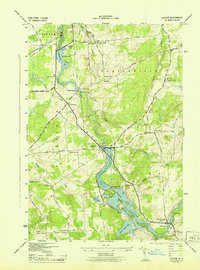
1943 Map of Colton
USGS Topo · Published 1943About this map
The Raquette River dictates the settlement pattern of this St. Lawrence County landscape, carving through the townships of Potsdam, Parishville, Pierrepont, and Colton. In the years during the Second World War, the river's power is harnessed at sites like Higley Falls and Three Falls, while the resulting impoundments create features such as Warm Brook Flow. Small rural centers are frequently anchored by numbered schoolhouses, including School No 7 near Green Pond and School No 14 at High Flats. The map reveals a transition from the larger village of Colton to smaller clusters like South Colton and Willisville. Road names such as Irish Settlement Road and French Hill Rd suggest the varied ethnic heritage of the local farming and logging families who established these communities along the river valley.
Find a feature on this map
58 named features on this map. Tap any name to fly to it.
Don’t see what you’re looking for? This feature index may not catch every label — zoom into the map to look around manually.
Map Details
Editions of this 1943 Colton Map
2 editions found
Other maps of this area

1908 · Potsdam
USGS Topo · 1:62,500

1910 · Canton
USGS Topo · 1:62,500

1911 · Canton
USGS Topo · 1:62,500

1915 · Russell
USGS Topo · 1:62,500

1918 · Russell
USGS Topo · 1:62,500

1921 · Stark
USGS Topo · 1:62,500

1923 · Stark
USGS Topo · 1:62,500

1940 · Stark
USGS Topo · 1:62,500

1942 · Long Bow
USGS Topo · 1:24,000

1943 · Potsdam
USGS Topo · 1:31,680