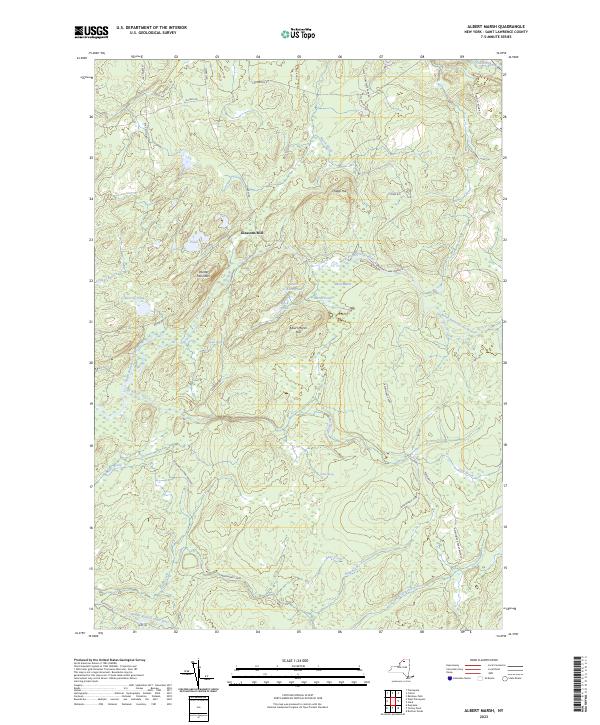
2023 Map of Albert Marsh
USGS Topo · Published 2023About this map
Gleasons Mill sits at the heart of this landscape, a remnant of local industry within the heavily forested and boggy terrain of the Adirondack Park. The area is defined by complex water systems, including the North Branch Grass River and Middle Branch Grass River, which carve through the elevations of Painter Mountain and Chapp Hill. The map highlights a concentration of marshland and small water bodies such as Albert Marsh, Little Rock Pond, and Marsh Pond.
Find a feature on this map
39 named features on this map. Tap any name to fly to it.
Don’t see what you’re looking for? This feature index may not catch every label — zoom into the map to look around manually.
Map Details
Editions of this 2023 Albert Marsh Map
This is the sole edition of this map. No revisions or reprints were ever made.
Other maps of this area

1908 · Potsdam
USGS Topo · 1:62,500

1910 · Canton
USGS Topo · 1:62,500

1911 · Canton
USGS Topo · 1:62,500

1915 · Russell
USGS Topo · 1:62,500

1918 · Russell
USGS Topo · 1:62,500

1921 · Stark
USGS Topo · 1:62,500

1923 · Stark
USGS Topo · 1:62,500

1940 · Stark
USGS Topo · 1:62,500

1942 · Long Bow
USGS Topo · 1:24,000
1943 · Colton
USGS Topo · 1:31,680