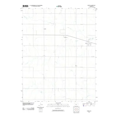
2009 Map of Albert
USGS Topo · Published 2009About this map
Albert stands at the center of this agricultural landscape in Barton County, where the grid of rural roads meets the winding path of Walnut Creek. The settlement pattern is defined by sections of farmland, punctuated by the smaller community of Schaffer to the northwest. This area serves as a transition between the elevated plains and the stream valleys, with Dry Creek and Dry Walnut Creek carving drainage patterns across the southern half of the sheet. Industrial activity is concentrated north of the town center at the Otis-Albert Oil and Gas Field, indicating the importance of energy extraction alongside traditional prairie farming. For those researching local roots, the Albert Cemetery remains a key landmark situated along NW 140 Ave, south of the main township, while the local street names in town like Eugene and Main St provide fine-grained detail of the village's layout during the early twenty-first century.
Find a feature on this map
21 named features on this map. Tap any name to fly to it.
Don’t see what you’re looking for? This feature index may not catch every label — zoom into the map to look around manually.
Map Details
Editions of this 2009 Albert Map
This is the sole edition of this map. No revisions or reprints were ever made.
Other maps of this area

1889 · Larned
USGS Topo · 1:125,000

1891 · Great Bend
USGS Topo · 1:125,000

1891 · Larned
USGS Topo · 1:125,000

1893 · Great Bend
USGS Topo · 1:125,000

1896 · Russell
USGS Topo · 1:125,000

1896 · Hays
USGS Topo · 1:125,000

1955 · Great Bend
USGS Topo · 1:250,000

1957 · Great Bend
USGS Topo · 1:250,000

1958 · Great Bend
USGS Topo · 1:250,000

1960 · Pawnee Rock
USGS Topo · 1:24,000