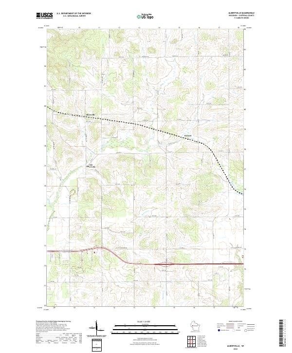
2022 Map of Albertville
USGS Topo · Published 2022About this map
Albertville serves as a central point in this part of Chippewa County, where local roads converge in a landscape defined by agricultural plots and small tributaries. The map reveals the relationship between modern Albertville and the nearby site of Old Albertville to the south, suggesting a shift in the local center over time as transportation and development patterns evolved. Running through the northeastern corner, Little Hay Cr drains the undulating terrain that characterizes the township borders of t29n r10w and t29n r9w. Further east, the small settlement of Howard sits near the headwaters of local drainages, illustrating the historical footprint of rural Wisconsin communities that grew alongside these small watercourses and regional farm roads.
Find a feature on this map
8 named features on this map. Tap any name to fly to it.
Don’t see what you’re looking for? This feature index may not catch every label — zoom into the map to look around manually.
Map Details
Editions of this 2022 Albertville Map
This is the sole edition of this map. No revisions or reprints were ever made.
Other maps of this area

1934 · Elk Mound
USGS Topo · 1:62,500

1934 · Chippewa Falls
USGS Topo · 1:62,500

1936 · Chippewa Falls
USGS Topo · 1:62,500

1936 · Elk Mound
USGS Topo · 1:62,500

1949 · Bloomer
USGS Topo · 1:62,500

1949 · New Auburn
USGS Topo · 1:62,500

1951 · Bloomer
USGS Topo · 1:62,500

1951 · New Auburn
USGS Topo · 1:62,500

1953 · Eau Claire
USGS Topo · 1:250,000

1953 · Rice Lake
USGS Topo · 1:250,000