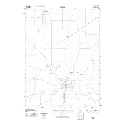
2010 Map of Albia
USGS Topo · Published 2010About this map
Albia serves as the central hub for this corner of Monroe County, showing the intersection of local industry and agriculture in the early 21st century. The map details the town's core, including the Albia Post Office and the centralized Oak View Cemetery and Saint Marys Cemetery. Outside the municipal limits, the landscape transitions into a network of creek valleys, most notably Miller Creek and Cedar Creek, which define the drainage patterns of the region. To the north, the Miami Lake State Game Management Area surrounds Lake Miami, held by the Lake Miami Dam. This map is particularly useful for those tracing family history or local development, as it preserves the locations of several rural burial grounds such as Union Chapel Cemetery and Service Chapel Cemetery, as well as local landmarks like the Monroe County Fairground and O'Brien Landing Strip.
Find a feature on this map
67 named features on this map. Tap any name to fly to it.
Don’t see what you’re looking for? This feature index may not catch every label — zoom into the map to look around manually.
Map Details
Editions of this 2010 Albia Map
This is the sole edition of this map. No revisions or reprints were ever made.
Other maps of this area

1929 · Albia
USGS Topo · 1:62,500

1939 · Mystic
USGS Topo · 1:62,500

1942 · Mystic
USGS Topo · 1:62,500

1954 · Centerville
USGS Topo · 1:250,000

1954 · Des Moines
USGS Topo · 1:250,000

1956 · Des Moines
USGS Topo · 1:250,000

1957 · Des Moines
USGS Topo · 1:250,000

1957 · Centerville
USGS Topo · 1:250,000

1958 · Centerville
USGS Topo · 1:250,000

1968 · Eddyville
USGS Topo · 1:24,000