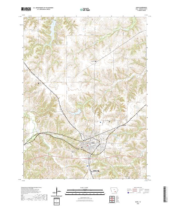
2022 Map of Albia
USGS Topo · Published 2022About this map
The Monroe County Courthouse stands as the central landmark of Albia, Iowa, anchoring a landscape where small-town industry meets the rolling topography of the Southern Iowa Drift Plain. This survey captures the town's modern footprint, framed by a network of drainage systems including Little Avery Cr and Miller Cr. The local geography is defined by its social and infrastructure heritage, visible in the numerous burial grounds like Oakview Cem and Saint Marys Cem that border the settlement. To the east, the small community of Maxon and the Maxon Reservoir illustrate the regional water management and historical rail-path connections typical of Monroe County. Agricultural utility is evident in the dense section-line road grid, while peripheral sites like Union Chapel Cem and Service Chapel Cem provide critical touchpoints for genealogical research in the outlying townships.
Find a feature on this map
94 named features on this map. Tap any name to fly to it.
Don’t see what you’re looking for? This feature index may not catch every label — zoom into the map to look around manually.
Map Details
Editions of this 2022 Albia Map
This is the sole edition of this map. No revisions or reprints were ever made.
Other maps of this area

1929 · Albia
USGS Topo · 1:62,500

1939 · Mystic
USGS Topo · 1:62,500

1942 · Mystic
USGS Topo · 1:62,500

1954 · Centerville
USGS Topo · 1:250,000

1954 · Des Moines
USGS Topo · 1:250,000

1956 · Des Moines
USGS Topo · 1:250,000

1957 · Des Moines
USGS Topo · 1:250,000

1957 · Centerville
USGS Topo · 1:250,000

1958 · Centerville
USGS Topo · 1:250,000

1968 · Eddyville
USGS Topo · 1:24,000