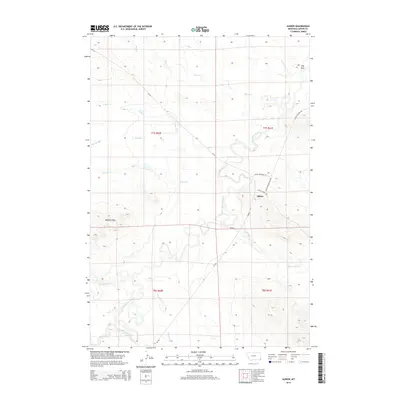
2014 Map of Albion
USGS Topo · Published 2014About this map
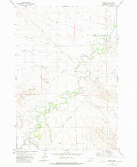
The settlement of Albion serves as the focal point of this 2014 survey in Montana’s southeastern corner. The landscape is defined by the winding course of the Little Missouri River, which meanders through a network of drainages and seasonal watercourses. To the southwest, the Butcher Hills provide a distinctive elevation change in an otherwise drainage-heavy terrain. This area is characterized by its tributary system, where features like Ninemile Creek, Twentymile Creek, and North Butte Creek carve through the land before joining the main river valley. Local transport relies on routes such as Highway 323 and Little Missouri Road, which connect the isolated ranching community to the surrounding plains. The map illustrates a ranching-centric geography where named draws like Hay Draw and small creek systems dictated early settlement patterns and land use.
Find a feature on this map
22 named features on this map. Tap any name to fly to it.
Don’t see what you’re looking for? This feature index may not catch every label — zoom into the map to look around manually.
Map Details
Editions of this 2014 Albion Map
This is the sole edition of this map. No revisions or reprints were ever made.
Other maps of this area

1954 · Ekalaka
USGS Topo · 1:250,000

1956 · Ekalaka
USGS Topo · 1:250,000

1958 · Ekalaka
USGS Topo · 1:250,000

1965 · Ekalaka
USGS Topo · 1:250,000
1980 · Alzada NW
USGS Topo · 1:24,000
1980 · Elkhorn Creek SW
USGS Topo · 1:24,000

1980 · Cactus Creek West
USGS Topo · 1:24,000

1980 · Finger Buttes East
USGS Topo · 1:24,000
1980 · Sevenmile Creek
USGS Topo · 1:24,000
1980 · Albion
USGS Topo · 1:24,000