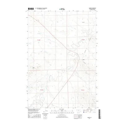
2017 Map of Albion
USGS Topo · Published 2017About this map
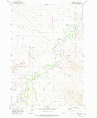
The Little Missouri River meanders through this portion of Carter County, shaping a landscape defined by seasonal drainages and local topography. In the central eastern portion of the sheet, the small settlement of Albion sits at a junction of local routes, including Camp Crook Rd and Indian Creek Rd. This area of southeastern Montana is characterized by its drainage network, with Ninemile Cr, Twelvemile Cr, and Hay Draw feeding into the river system. To the southwest, the Butcher Hills provide a distinct change in elevation against the surrounding plains. The map reveals a land divided by the Public Land Survey System, with the intersection of t7s r60e, t7s r61e, t8s r60e, and t8s r61e meeting near the river's path, illustrating the rural grid that governs this cattle country.
Find a feature on this map
18 named features on this map. Tap any name to fly to it.
Don’t see what you’re looking for? This feature index may not catch every label — zoom into the map to look around manually.
Map Details
Editions of this 2017 Albion Map
This is the sole edition of this map. No revisions or reprints were ever made.
Other maps of this area

1954 · Ekalaka
USGS Topo · 1:250,000

1956 · Ekalaka
USGS Topo · 1:250,000

1958 · Ekalaka
USGS Topo · 1:250,000

1965 · Ekalaka
USGS Topo · 1:250,000
1980 · Alzada NW
USGS Topo · 1:24,000
1980 · Elkhorn Creek SW
USGS Topo · 1:24,000

1980 · Cactus Creek West
USGS Topo · 1:24,000

1980 · Finger Buttes East
USGS Topo · 1:24,000
1980 · Sevenmile Creek
USGS Topo · 1:24,000
1980 · Albion
USGS Topo · 1:24,000