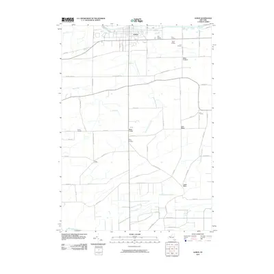
2010 Map of Albion
USGS Topo · Published 2010About this map
The Erie Canal defines the northern edge of this landscape, tracing the historic commercial artery through the village of Albion. Moving south from the canal, the terrain is shaped by the drainage of West Branch Sandy Creek and Otter Creek, supporting a network of rural hamlets including Barre Center, East Barre, and South Barre. The map reveals a dense distribution of local burial grounds, such as Mount Albion Cemetery, Saint Josephs Cemetery, and several family-named plots like Annis Cemetery and Love Cemetery, which offer significant value for genealogical research.
Find a feature on this map
62 named features on this map. Tap any name to fly to it.
Don’t see what you’re looking for? This feature index may not catch every label — zoom into the map to look around manually.
Map Details
Editions of this 2010 Albion Map
This is the sole edition of this map. No revisions or reprints were ever made.
Other maps of this area

1897 · Albion
USGS Topo · 1:62,500

1897 · Medina
USGS Topo · 1:62,500

1897 · Oak Orchard
USGS Topo · 1:62,500

1897 · Ridgeway
USGS Topo · 1:62,500

1944 · Holley
USGS Topo · 1:31,680

1944 · Byron
USGS Topo · 1:31,680

1944 · Ashwood
USGS Topo · 1:31,680

1944 · Albion
USGS Topo · 1:31,680

1949 · Kendall
USGS Topo · 1:62,500
1950 · Knowlesville
USGS Topo · 1:24,000