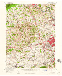
1957 Map of Alburtis
USGS Topo · Published 1960About this map
Blue Mountain anchors the northern ridge of this Pennsylvania landscape, where the Lehigh River carves a deep path through the Lehigh Valley. The late 1950s development of Allentown is evident in the burgeoning residential grids of Woodlawn and Park Way Manor, while the surrounding countryside maintains its deep-rooted agricultural and industrial character. The map documents a dense network of rail infrastructure, including the Lehigh Valley RR and the Central RR of New Jersey, which serviced the river corridor and the local quarries near Cementon and Egypt.
Find a feature on this map
157 named features on this map. Tap any name to fly to it.
Don’t see what you’re looking for? This feature index may not catch every label — zoom into the map to look around manually.
Map Details
Editions of this 1957 Alburtis Map
Other maps of this area

1888 · Quakertown
USGS Topo · 1:62,500

1889 · Hazleton
USGS Topo · 1:62,500

1890 · Quakertown
USGS Topo · 1:62,500

1891 · Hazleton
USGS Topo · 1:62,500

1893 · Hazleton
USGS Topo · 1:62,500

1894 · Reading
USGS Topo · 1:62,500

1894 · Allentown
USGS Topo · 1:62,500

1894 · Quakertown
USGS Topo · 1:62,500

1902 · Boyertown
USGS Topo · 1:62,500

1902 · Slatington
USGS Topo · 1:62,500