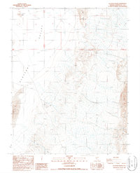
1987 Map of Alcatraz Island
USGS Topo · Published 1987About this map
Clayton Valley and its industrial mineral landscape dominate this 1987 survey, where expansive Evaporator Ponds indicate the active brine processing central to this part of Esmeralda County. The desert terrain is marked by distinctive features such as Alcatraz Island and Angel Island, which rise from the dry lake bed. Resource extraction is a primary theme of the era, evidenced by numerous Prospects and Borrow Pit excavations scattered across the eastern slopes of Clayton Ridge. Primitive 4wd tracks provide the only access through this arid environment, connecting the drainage of Lida Wash to the shifted sands of the Sand Dunes. The map documents a period of specialized mining and geothermal interest in the Great Basin, focusing on the infrastructure required to harness the valley's geological potential.
Find a feature on this map
13 named features on this map. Tap any name to fly to it.
Don’t see what you’re looking for? This feature index may not catch every label — zoom into the map to look around manually.
Map Details
Editions of this 1987 Alcatraz Island Map
This is the sole edition of this map. No revisions or reprints were ever made.
Other maps of this area

1898 · Silver Peak
USGS Topo · 1:125,000

1900 · Silver Peak
USGS Topo · 1:125,000

1908 · Lida
USGS Topo · 1:250,000

1913 · Lida
USGS Topo · 1:250,000

1945 · Goldfield
USGS Topo · 1:125,000

1954 · Goldfield
USGS Topo · 1:250,000

1955 · Goldfield
USGS Topo · 1:250,000

1958 · Goldfield
USGS Topo · 1:250,000

1962 · Goldfield
USGS Topo · 1:250,000

1963 · Silver Peak
USGS Topo · 1:62,500