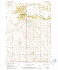
1968 Map of Alcester NE
USGS Topo · Published 1990About this map
Big Sioux River serves as the winding natural border between South Dakota and Iowa on this late 1960s survey, defining the rugged geography of Newton Hills. The landscape is dominated by the deeply eroded bluffs and timbered ravines of Newton Hills State Park, a stark contrast to the surrounding agricultural uplands. Evidence of the region’s rural development is visible in the network of country schools like Jensvold Sch and Moe Sch, alongside community anchors such as Trinity Ch and its accompanying North Trinity Cem.
Find a feature on this map
25 named features on this map. Tap any name to fly to it.
Don’t see what you’re looking for? This feature index may not catch every label — zoom into the map to look around manually.
Map Details
Editions of this 1968 Alcester NE Map
2 editions found
Other maps of this area

1897 · Canton
USGS Topo · 1:125,000

1900 · Canton
USGS Topo · 1:125,000

1955 · Sioux Falls
USGS Topo · 1:250,000

1958 · Sioux Falls
USGS Topo · 1:250,000

1962 · Canton
USGS Topo · 1:24,000

1964 · Canton SW
USGS Topo · 1:24,000

1968 · Alcester NW
USGS Topo · 1:24,000

1968 · Alcester NE
USGS Topo · 1:24,000
1968 · Alcester
USGS Topo · 1:24,000
1968 · Alcester SE
USGS Topo · 1:24,000