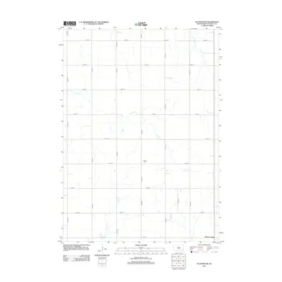
2012 Map of Alcester NW
USGS Topo · Published 2012About this map
Norway Center sits at the southern edge of this Lincoln County landscape, serving as a focal point in a region defined by its precise agricultural grid and meandering prairie streams. The terrain is patterned by a network of section-line roads, including 294th St and Tower Ave, which navigate around the various drainages that feed into the Big Sioux River watershed. Saddle Cr and W Brule Cr wind through these fields, their irregular paths contrasting with the rigid geometry of the surrounding farmland.
Find a feature on this map
22 named features on this map. Tap any name to fly to it.
Don’t see what you’re looking for? This feature index may not catch every label — zoom into the map to look around manually.
Map Details
Editions of this 2012 Alcester NW Map
This is the sole edition of this map. No revisions or reprints were ever made.
Other maps of this area

1897 · Canton
USGS Topo · 1:125,000

1900 · Canton
USGS Topo · 1:125,000

1955 · Sioux Falls
USGS Topo · 1:250,000

1958 · Sioux Falls
USGS Topo · 1:250,000

1962 · Canton
USGS Topo · 1:24,000

1964 · Canton SW
USGS Topo · 1:24,000

1964 · Worthing
USGS Topo · 1:24,000

1968 · Alcester NW
USGS Topo · 1:24,000

1968 · Alcester NE
USGS Topo · 1:24,000
1968 · Alcester
USGS Topo · 1:24,000