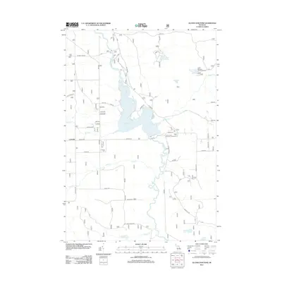
2012 Map of Alcona Dam Pond
USGS Topo · Published 2012About this map
The Au Sable River meanders through this portion of Alcona County, its course interrupted by the expansive Alcona Dam Pond. This landscape is defined by the water, with several small lakes scattered across the terrain including Sunny Lake, Horseshoe Lake, and Hoppy Lake. The settlement of Curtisville serves as a local anchor in the western section of the map, situated near the Curtisville Cem.
Find a feature on this map
36 named features on this map. Tap any name to fly to it.
Don’t see what you’re looking for? This feature index may not catch every label — zoom into the map to look around manually.
Map Details
Editions of this 2012 Alcona Dam Pond Map
This is the sole edition of this map. No revisions or reprints were ever made.
Other maps of this area

1954 · Tawas City
USGS Topo · 1:250,000

1958 · Tawas City
USGS Topo · 1:250,000

1959 · Tawas City
USGS Topo · 1:62,500

1959 · Glennie
USGS Topo · 1:62,500

1968 · Hale
USGS Topo · 1:24,000

1968 · South Branch
USGS Topo · 1:24,000

1972 · McKinley
USGS Topo · 1:24,000

1972 · Curran
USGS Topo · 1:24,000

1972 · Goodar
USGS Topo · 1:24,000

1972 · Alcona Dam Pond
USGS Topo · 1:24,000