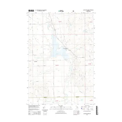
2014 Map of Alcona Dam Pond
USGS Topo · Published 2014About this map
Huron National Forest dominates this northern Michigan landscape, where the Au Sable River is widened into the expansive Alcona Dam Pond. The settlement of Curtisville serves as the primary terrestrial landmark in the western portion of the quadrangle, situated near the Curtisville Cem. The terrain is defined by a complex network of glacial hydrology, including numerous isolated water bodies such as Sunny Lake, Honawan Lake, and Horseshoe Lake to the north, and Grassy Lake and Stuart Lake near the Alcona Co Iosco Co line to the south. The road system, featuring routes like Bamfield Rd and Au Sable Rd, follows the irregular topography around the river's basin. This 2014 representation captures the area's transition between managed forest lands and the riparian environment of the Au Sable watershed.
Find a feature on this map
40 named features on this map. Tap any name to fly to it.
Don’t see what you’re looking for? This feature index may not catch every label — zoom into the map to look around manually.
Map Details
Editions of this 2014 Alcona Dam Pond Map
This is the sole edition of this map. No revisions or reprints were ever made.
Other maps of this area

1954 · Tawas City
USGS Topo · 1:250,000

1958 · Tawas City
USGS Topo · 1:250,000

1959 · Tawas City
USGS Topo · 1:62,500

1959 · Glennie
USGS Topo · 1:62,500

1968 · Hale
USGS Topo · 1:24,000

1968 · South Branch
USGS Topo · 1:24,000

1972 · McKinley
USGS Topo · 1:24,000

1972 · Curran
USGS Topo · 1:24,000

1972 · Goodar
USGS Topo · 1:24,000

1972 · Alcona Dam Pond
USGS Topo · 1:24,000