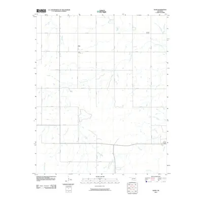
2010 Map of Alden
USGS Topo · Published 2010About this map
Alden sits at the intersection of a sprawling rural road network in Caddo County, where the plains are carved by the winding passage of East Cache Creek. This 2010 survey illustrates a landscape primarily defined by its section-line roads and scattered agricultural holdings. Local heritage is preserved in quiet landmarks like the Alden Cemetery near the town center and the Greenfield Cemetery further to the northeast, offering important points of reference for genealogists and local historians. In the southeastern portion of the map, the terrain becomes more varied around the drainage of Tahoe Creek and Cook Creek, where Camp George Thomas provides a notable break from the surrounding farm and ranch land. The map reveals the persistent structure of Oklahoma's land survey system, with the precise grid of numbered roads like E 1400 RD and N 2470 RD framing the watercourses that have shaped the area's development.
Find a feature on this map
22 named features on this map. Tap any name to fly to it.
Don’t see what you’re looking for? This feature index may not catch every label — zoom into the map to look around manually.
Map Details
Editions of this 2010 Alden Map
This is the sole edition of this map. No revisions or reprints were ever made.
Other maps of this area

1950 · Saddle Mountain
USGS Topo · 1:62,500

1951 · Fort Cobb
USGS Topo · 1:62,500

1955 · Lawton
USGS Topo · 1:250,000

1955 · Clinton
USGS Topo · 1:250,000

1956 · Saddle Mountain
USGS Topo · 1:24,000

1956 · Alden
USGS Topo · 1:24,000

1956 · Boone
USGS Topo · 1:24,000

1956 · Richards Spur
USGS Topo · 1:24,000

1956 · Bally Mountain
USGS Topo · 1:24,000

1956 · Meers
USGS Topo · 1:24,000