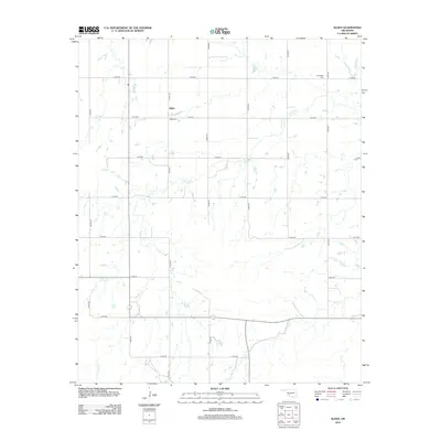
2012 Map of Alden
USGS Topo · Published 2012About this map
Alden sits at the heart of this Caddo County landscape, defined by a rigid grid of section roads that overlay a complex network of natural waterways. The settlement is anchored by local history markers like the Alden Cem, while the northern reaches of the quadrangle include the Greenfield Cem. This area of Oklahoma is characterized by the meandering paths of E Cache Cr, which winds through the central territory, and Tahoe Cr to the south. The intersection of local routes such as n2470 RD and e1410 RD provides a framework for the rural homesteads and agricultural operations that have shaped the region since the early twentieth century. The presence of Cook Cr in the southeast corner further emphasizes the importance of drainage and water access in this prairie environment.
Find a feature on this map
20 named features on this map. Tap any name to fly to it.
Don’t see what you’re looking for? This feature index may not catch every label — zoom into the map to look around manually.
Map Details
Editions of this 2012 Alden Map
This is the sole edition of this map. No revisions or reprints were ever made.
Other maps of this area

1950 · Saddle Mountain
USGS Topo · 1:62,500

1951 · Fort Cobb
USGS Topo · 1:62,500

1955 · Lawton
USGS Topo · 1:250,000

1955 · Clinton
USGS Topo · 1:250,000

1956 · Saddle Mountain
USGS Topo · 1:24,000

1956 · Alden
USGS Topo · 1:24,000

1956 · Boone
USGS Topo · 1:24,000

1956 · Richards Spur
USGS Topo · 1:24,000

1956 · Bally Mountain
USGS Topo · 1:24,000

1956 · Meers
USGS Topo · 1:24,000