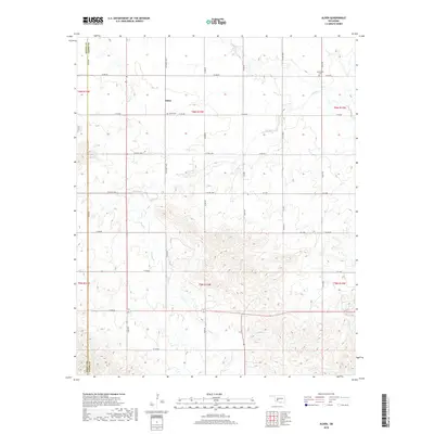
2018 Map of Alden
USGS Topo · Published 2018About this map
Alden sits along the section line of CO Street 2470 and E1410 Rd, serving as a central point for the surrounding Caddo County ranching and agricultural landscape. This 2018 survey illustrates a rural terrain deeply carved by the drainage systems of E Cache Cr, Tahoe Cr, and Cook Cr. The map preserves the location of local burial grounds, including Alden Cem near the town center and Greenfield Cem to the northeast, which provide essential spatial context for genealogists and local historians. The landscape is defined by the rectilinear grid of county roads like N2480 Rd and N2510 Rd, which cut across the varying elevations and creek beds. The boundary between Kiowa and Caddo counties is clearly delineated along the western edge, marking the transition between these two Oklahoma territories.
Find a feature on this map
37 named features on this map. Tap any name to fly to it.
Don’t see what you’re looking for? This feature index may not catch every label — zoom into the map to look around manually.
Map Details
Editions of this 2018 Alden Map
This is the sole edition of this map. No revisions or reprints were ever made.
Other maps of this area

1950 · Saddle Mountain
USGS Topo · 1:62,500

1951 · Fort Cobb
USGS Topo · 1:62,500

1955 · Lawton
USGS Topo · 1:250,000

1955 · Clinton
USGS Topo · 1:250,000

1956 · Saddle Mountain
USGS Topo · 1:24,000

1956 · Alden
USGS Topo · 1:24,000

1956 · Boone
USGS Topo · 1:24,000

1956 · Richards Spur
USGS Topo · 1:24,000

1956 · Bally Mountain
USGS Topo · 1:24,000

1956 · Meers
USGS Topo · 1:24,000