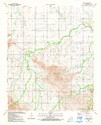
1991 Map of Alden
USGS Topo · Published 1992About this map
Alden anchors this section of the Great Plains, where the intersection of rural community life and resource extraction is clearly etched onto the landscape. The northern reaches are defined by a significant Oil Field and numerous Drill Hole locations, while the southern terrain transitions into more varied topography where industrial activity includes a Quarry and Gravel Pit. The map is particularly rich for genealogical research, documenting local spiritual centers such as Greenfield Ch, Community Ch, Cache Creek Ch, and the Cache Indian Mission. These religious and social landmarks sit alongside East Cache Creek and Tahoe Creek, which drain the region. Further south, the presence of Camp George Thomas highlights a recreational or organizational footprint amidst the winding creek beds and spring-fed waters of Caddo County.
Find a feature on this map
15 named features on this map. Tap any name to fly to it.
Don’t see what you’re looking for? This feature index may not catch every label — zoom into the map to look around manually.
Map Details
Editions of this 1991 Alden Map
This is the sole edition of this map. No revisions or reprints were ever made.
Other maps of this area

1950 · Saddle Mountain
USGS Topo · 1:62,500

1951 · Fort Cobb
USGS Topo · 1:62,500

1955 · Lawton
USGS Topo · 1:250,000

1955 · Clinton
USGS Topo · 1:250,000

1956 · Saddle Mountain
USGS Topo · 1:24,000

1956 · Alden
USGS Topo · 1:24,000

1956 · Boone
USGS Topo · 1:24,000

1956 · Richards Spur
USGS Topo · 1:24,000

1956 · Bally Mountain
USGS Topo · 1:24,000

1956 · Meers
USGS Topo · 1:24,000