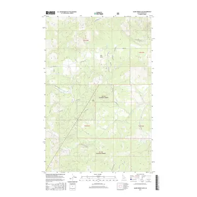
2017 Map of Alder Creek Flats
USGS Topo · Published 2017About this map
Alder Creek Flats serves as the central focal point for this Benewah County landscape, characterized by the dense drainage networks of the St Joe National Forest. The geography is defined by a series of distinct watercourses, including Alder Creek and its North Fork, alongside the southward-flowing John Creek and Happy Creek. These streams create a complex system of ridges and valleys, with John Point standing as a significant topographic landmark in the center of the survey area.
Find a feature on this map
35 named features on this map. Tap any name to fly to it.
Don’t see what you’re looking for? This feature index may not catch every label — zoom into the map to look around manually.
Map Details
Editions of this 2017 Alder Creek Flats Map
This is the sole edition of this map. No revisions or reprints were ever made.
Other maps of this area

1955 · Spokane
USGS Topo · 1:250,000

1957 · St. Maries
USGS Topo · 1:62,500

1957 · Emida
USGS Topo · 1:62,500

1957 · Plummer
USGS Topo · 1:62,500

1957 · Tensed
USGS Topo · 1:62,500

1958 · Spokane
USGS Topo · 1:250,000

1975 · Plummer SE
USGS Topo · 1:24,000

1981 · St Maries
USGS Topo · 1:100,000
1981 · St Maries
USGS Topo · 1:24,000
1981 · Benewah Lake
USGS Topo · 1:24,000