
1981 Map of St Maries
USGS Topo · Published 1981About this map
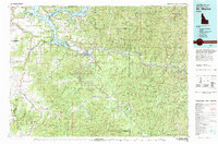
St Joe River and the St Maries River converge at the regional hub of St Maries, where the water-bound transport economy meets the rail lines of the Chicago Milwaukee St Paul and Pacific and Union Pacific. This 1981 survey reveals a landscape deeply defined by timber and transit, showing the timberlands of the St Joe National Forest and Coeur d'Alene National Forest. To the west, the map details the southern reaches of Coeur d'Alene Lake and the complex of smaller waters like Chatcolet Lake and Round Lake within Heyburn State Park. Smaller settlements such as Harrison, Plummer, and De Smet anchor the surrounding plateaus and river valleys. The terrain transitions from the high peaks of the St Joe Mountains, including Mt Wiessner and Grandfather Mtn, down to the fertile Harrison Flats, illustrating the varied geography of the Idaho Panhandle.
Find a feature on this map
97 named features on this map. Tap any name to fly to it.
Don’t see what you’re looking for? This feature index may not catch every label — zoom into the map to look around manually.
Map Details
Editions of this 1981 St Maries Map
2 editions found
Other maps of this area

1901 · Spokane
USGS Topo · 1:125,000

1901 · Coeur D'Alene District
USGS Topo · 1:62,500

1903 · Oakesdale
USGS Topo · 1:125,000

1903 · Rathdrum
USGS Topo · 1:125,000

1903 · Coeur D'Alene District
USGS Topo · 1:62,500

1905 · Oakesdale
USGS Topo · 1:125,000

1906 · Coeur D'Alene District
USGS Topo · 1:62,500

1909 · Cataldo
USGS Topo · 1:125,000

1910 · Pullman
USGS Topo · 1:125,000

1911 · Cataldo
USGS Topo · 1:125,000