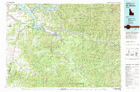
1981 Map of St Maries
USGS Topo · Published 1981About this map
The St Joe River meanders through the heart of this North Idaho landscape, creating a complex system of waterways including Anderson Lake, Black Lake, and Chatcolet Lake. These river-fed lakes are central to the region's geography, with Harrison situated near the confluence of the river and Coeur d'Alene Lake. The map illustrates a transitional economy where established mountain settlements like Fernwood and Santa are connected by the St Maries River Railroad, supporting the timber and transport industries of the St Joe Mountains.
Find a feature on this map
107 named features on this map. Tap any name to fly to it.
Don’t see what you’re looking for? This feature index may not catch every label — zoom into the map to look around manually.
Map Details
Editions of this 1981 St Maries Map
2 editions found

Other maps of this area

1901 · Spokane
USGS Topo · 1:125,000

1901 · Coeur D'Alene District
USGS Topo · 1:62,500

1903 · Oakesdale
USGS Topo · 1:125,000

1903 · Rathdrum
USGS Topo · 1:125,000

1903 · Coeur D'Alene District
USGS Topo · 1:62,500

1905 · Oakesdale
USGS Topo · 1:125,000

1906 · Coeur D'Alene District
USGS Topo · 1:62,500

1909 · Cataldo
USGS Topo · 1:125,000

1910 · Pullman
USGS Topo · 1:125,000

1911 · Cataldo
USGS Topo · 1:125,000