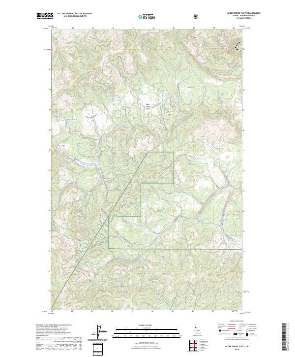
2024 Map of Alder Creek Flats
USGS Topo · Published 2024About this map
St. Joe National Forest encompasses a significant portion of this Idaho landscape, where the Saint Maries River cuts through the northeastern corner of the sheet. The settlement of Alder Creek Flats serves as a central point of interest, surrounded by a complex network of forest roads and creek-side trails. This area is defined by its dramatic drainage systems, including North Fork Alder Creek, John Creek, and Happy Creek, which feed into the larger river system. Navigation through the timbered terrain is documented via numerous Forest Service routes like Nat For Dev Rd 382 and NFD 387 Rd, while high points such as John Point provide topographical orientation for those studying the regional geography of Benewah County.
Find a feature on this map
31 named features on this map. Tap any name to fly to it.
Don’t see what you’re looking for? This feature index may not catch every label — zoom into the map to look around manually.
Map Details
Editions of this 2024 Alder Creek Flats Map
This is the sole edition of this map. No revisions or reprints were ever made.
Other maps of this area

1955 · Spokane
USGS Topo · 1:250,000

1957 · St. Maries
USGS Topo · 1:62,500

1957 · Emida
USGS Topo · 1:62,500

1957 · Plummer
USGS Topo · 1:62,500

1957 · Tensed
USGS Topo · 1:62,500

1958 · Spokane
USGS Topo · 1:250,000

1975 · Plummer SE
USGS Topo · 1:24,000

1981 · St Maries
USGS Topo · 1:100,000
1981 · St Maries
USGS Topo · 1:24,000
1981 · Benewah Lake
USGS Topo · 1:24,000