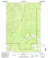
1996 Map of Alder Gulch
USGS Topo · Published 1998About this map
The Deerlodge National Forest and Lolo National Forest converge in this high-elevation portion of Granite County, defining a landscape of deep drainages and prominent divides. Significant geographical markers like Hogback Ridge and Sandstone Ridge partition the terrain, which is dominated by a complex network of seasonal and perennial streams. The drainage patterns, including Alder Gulch and Niles Gulch, illustrate the watershed of the Sapphire Mountains before the turn of the 21st century. Access into the back-country is highlighted by the Ranch Creek Trail, reflecting the area's primary use for timber management and forest recreation. While largely devoid of permanent settlements, the map details numerous named features like Scotchman Gulch and Baboon Gulch that provide specific geographic references for those studying local land-use history or forest management boundaries.
Find a feature on this map
36 named features on this map. Tap any name to fly to it.
Don’t see what you’re looking for? This feature index may not catch every label — zoom into the map to look around manually.
Map Details
Editions of this 1996 Alder Gulch Map
This is the sole edition of this map. No revisions or reprints were ever made.
Other maps of this area

1903 · Bonner
USGS Topo · 1:125,000

1908 · Philipsburg
USGS Topo · 1:125,000

1909 · Sapphire
USGS Topo · 1:125,000

1919 · Drummond
USGS Topo · 1:125,000

1921 · Drummond
USGS Topo · 1:125,000

1947 · Butte
USGS Topo · 1:250,000

1958 · Butte
USGS Topo · 1:250,000

1959 · Bearmouth
USGS Topo · 1:62,500

1959 · Ravenna
USGS Topo · 1:62,500

1960 · Butte
USGS Topo · 1:250,000