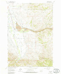
1963 Map of Alder
USGS Topo · Published 1986About this map
Alder Gulch Dredge Tailings dominate the central landscape of this Madison County survey, evidence of the massive industrial gold mining that reshaped the terrain. Following the course of Alder Gulch toward the Ruby Valley, these gravel deposits sit just east of the town of Alder, where the Northern Pacific railroad terminates. The map reveals a transition from the intensive mining works of the gulch to the agricultural flats of The Island, bounded by the Ruby River and Clear Creek. To the north, the small settlement of Laurin and the Laurin Cem provide key points for genealogists researching early pioneer families. Further south and east, the landscape rises into mineral-rich hills marked by the St Lawrence Mine, Silver Bell Mine, and Cook Mine, illustrating the persistent search for ore beyond the primary placer deposits.
Find a feature on this map
30 named features on this map. Tap any name to fly to it.
Don’t see what you’re looking for? This feature index may not catch every label — zoom into the map to look around manually.
Map Details
Editions of this 1963 Alder Map
3 editions found
Other maps of this area

1888 · Three Forks
USGS Topo · 1:250,000

1893 · Dillon
USGS Topo · 1:250,000

1894 · Three Forks
USGS Topo · 1:250,000

1895 · Three Forks
USGS Topo · 1:250,000

1947 · Bozeman
USGS Topo · 1:250,000

1948 · Bozeman
USGS Topo · 1:250,000

1949 · Varney
USGS Topo · 1:62,500

1950 · Virginia City
USGS Topo · 1:62,500

1955 · Bozeman
USGS Topo · 1:250,000

1955 · Dillon
USGS Topo · 1:250,000