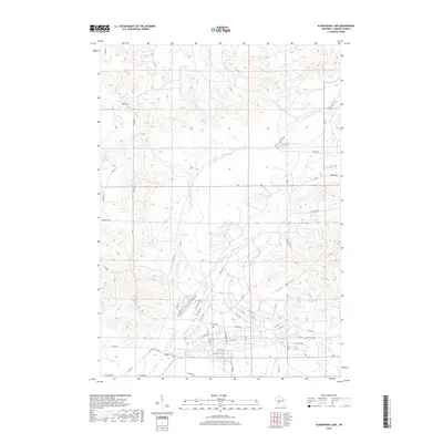
2018 Map of Alderwood Lake
USGS Topo · Published 2018About this map
The La Crosse River carves a central path through this section of Monroe County, defining a landscape of distinct drainage basins and valley systems. Significant topographic transitions are evident at Dorn Cut, while the broader terrain is marked by Lemon Valley and Tarr Valley to the south. Water is a defining feature of the area, ranging from the established Hazel Dell Lake and Alder Lake 19 in the north to the more recently named Suukjak Sep Lake near the river’s bend. Local history researchers will find the Lafayette Cem situated near the intersection of Buckley Ct and Co Hwy BB, serving as a primary genealogical landmark. The map details a dense network of local routes such as Birch Rd and Firefly Rd that provide access to the various creeks, including Squaw Cr and Stillwell Cr.
Find a feature on this map
52 named features on this map. Tap any name to fly to it.
Don’t see what you’re looking for? This feature index may not catch every label — zoom into the map to look around manually.
Map Details
Editions of this 2018 Alderwood Lake Map
This is the sole edition of this map. No revisions or reprints were ever made.
Other maps of this area

1909 · Sparta
USGS Topo · 1:62,500

1916 · Tomah
USGS Topo · 1:62,500

1928 · Melrose
USGS Topo · 1:48,000

1947 · Millston
USGS Topo · 1:62,500

1947 · Sparta
USGS Topo · 1:62,500

1949 · Millston
USGS Topo · 1:62,500

1949 · Sparta
USGS Topo · 1:62,500

1949 · Tomah
USGS Topo · 1:62,500

1949 · Melrose
USGS Topo · 1:62,500

1953 · Eau Claire
USGS Topo · 1:250,000