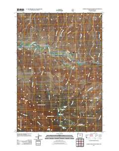
2011 Map of Aldrich Mountain North
USGS Topo · Published 2011About this map
John Day River flows through this portion of Grant County, serving as a central artery for the surrounding high-altitude terrain. The topography is defined by the significant rise toward Aldrich Mountain and Little Aldrich Mountain in the south, while the northern landscape is carved by numerous drainages like Scotty Creek and Stockdale Creek. A cluster of small upland water bodies including Pinchot Lake, Roosevelt Lake, and Stewart Lake sit high in the drainage basins, illustrating the complex hydrology of this mountainous region. Local history and early land use are signaled by features such as Stewarts Crossing and Schoolhouse Gulch, which point to a time of more dispersed rural activity. The presence of irrigation infrastructure like the Stewart Ditch alongside natural features like Chilkoot Pass and Chicken Springs provides a detailed look at how water management and topography shaped travel and settlement in these highlands during the early twenty-first century.
Find a feature on this map
27 named features on this map. Tap any name to fly to it.
Don’t see what you’re looking for? This feature index may not catch every label — zoom into the map to look around manually.
Map Details
Editions of this 2011 Aldrich Mountain North Map
This is the sole edition of this map. No revisions or reprints were ever made.
Other maps of this area

1932 · Dayville
USGS Topo · 1:125,000

1936 · Dayville
USGS Topo · 1:125,000

1940 · Aldrich Mtn.
USGS Topo · 1:62,500

1943 · Aldrich Mtn.
USGS Topo · 1:62,500

1951 · Courtrock
USGS Topo · 1:62,500

1953 · Picture
USGS Topo · 1:62,500

1955 · Canyon City
USGS Topo · 1:250,000

1959 · Canyon City
USGS Topo · 1:250,000

1972 · Big Weasel Sprs
USGS Topo · 1:24,000
1972 · Aldrich Mountain North
USGS Topo · 1:24,000