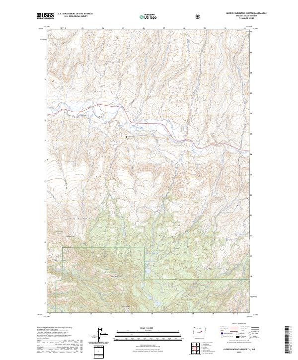
2023 Map of Aldrich Mountain North
USGS Topo · Published 2023About this map
The Aldrich Mountains dominate this Grant County landscape, providing a high-elevation backdrop to the John Day River valley. A site of particular historical note is the Aldrich Grave, located just south of the river and near the Cheechako Ranch. This area reflects the mid-elevation ranching and forestry economy of eastern Oregon, where irrigation infrastructure like the Stewart Ditch supports valley floor operations. High in the Malheur National Forest, the terrain rises toward peaks such as Little Aldrich Mtn and Aldrich Mtn. Several high-country water bodies, including Pinchot Lake, Roosevelt Lake, and Stewart Lake, are situated along the southern ridges. Travel through the high country is marked by Chilkoot Pass and landmarks such as Dead Pine, illustrating the importance of named points in this expansive timber and rangeland.
Find a feature on this map
37 named features on this map. Tap any name to fly to it.
Don’t see what you’re looking for? This feature index may not catch every label — zoom into the map to look around manually.
Map Details
Editions of this 2023 Aldrich Mountain North Map
This is the sole edition of this map. No revisions or reprints were ever made.
Other maps of this area

1932 · Dayville
USGS Topo · 1:125,000

1936 · Dayville
USGS Topo · 1:125,000

1940 · Aldrich Mtn.
USGS Topo · 1:62,500

1943 · Aldrich Mtn.
USGS Topo · 1:62,500

1951 · Courtrock
USGS Topo · 1:62,500

1953 · Picture
USGS Topo · 1:62,500

1955 · Canyon City
USGS Topo · 1:250,000

1959 · Canyon City
USGS Topo · 1:250,000

1972 · Big Weasel Sprs
USGS Topo · 1:24,000
1972 · Aldrich Mountain North
USGS Topo · 1:24,000