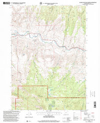
1998 Map of Aldrich Mountain North
USGS Topo · Published 2000About this map
The John Day River carves a significant course through this portion of Grant County, serving as a primary corridor for early movement and settlement. Near the riverbanks, points like Stewarts Crossing and the Aldrich Grave indicate the human footprint on this high-elevation landscape, where cattle ranching and resource management defined the economy. The presence of the Communication Tower and various gravel pits suggests the transition toward modern infrastructure and road maintenance within the rugged interior.
Find a feature on this map
39 named features on this map. Tap any name to fly to it.
Don’t see what you’re looking for? This feature index may not catch every label — zoom into the map to look around manually.
Map Details
Editions of this 1998 Aldrich Mountain North Map
This is the sole edition of this map. No revisions or reprints were ever made.
Other maps of this area

1932 · Dayville
USGS Topo · 1:125,000

1936 · Dayville
USGS Topo · 1:125,000

1940 · Aldrich Mtn.
USGS Topo · 1:62,500

1943 · Aldrich Mtn.
USGS Topo · 1:62,500

1951 · Courtrock
USGS Topo · 1:62,500

1953 · Picture
USGS Topo · 1:62,500

1955 · Canyon City
USGS Topo · 1:250,000

1959 · Canyon City
USGS Topo · 1:250,000

1972 · Big Weasel Sprs
USGS Topo · 1:24,000
1972 · Aldrich Mountain North
USGS Topo · 1:24,000